
Susan Alcorn’s Backpacking & Hiking Tales and Tips, #292 May 2024
Contents:
1. Seven Reasons to Use a Hiking Umbrella
2. It’s Not Dew
3. Gear Cleaning, Repair, and Maintenance by Treeline Review
4. New rules for airlines should benefit passengers.
5. Are Baby Rattlesnakes the Most Dangerous Biters?
6. Regional: Springtime Hikes in a New Bay Area Preserve: Welcome to Máyyan ‘Ooyákma /Coyote Ridge
7. Regional: ParkFest: Celebrating 90 Years of Your East Bay Regional Parks
Articles:
#1. Seven Reasons to Use a Hiking Umbrella. And it’s for a lot more than the routine writes Whitney LaRuffa. (Six Moon Designs. Jun 1, 2023.).
1. Shade on a sunny day. We all know the risks of exposure to too much sun and the potential for skin cancer. If you are like me, you burn easily and having to slather on tons of sunblock while hiking can be a chore, not to mention the extra weight in your pack. By using an umbrella, I can walk in the shade all day long, it helps protect me form harmful UV rays all the while keeping me cool as a I pound out the miles.
Susan adds: A couple of years back I did an experiment on my back deck to see how the temperature would differ on our table with and without an umbrella. It was unscientific, but there was a measurable difference in the temperature between the shaded and non-shaded of degrees difference between the two situations. If you are hiking, this can make a big difference in your comfort and physical well-being.
2. Dry cover on a wet day. Let’s face it, hiking all day in the rain sucks. Besides being soggy, it can chill you to the bone and it makes breaks less than desirable. With an umbrella I can often hike with my rain jacket unzipped, it helps keep me remain drier as I move along, and best of all, it gives me a dry place to relax and snack during breaks.
Susan adds: There have been times when we have needed shelter in order to take a break or have lunch and we have turned to our umbrellas for help.
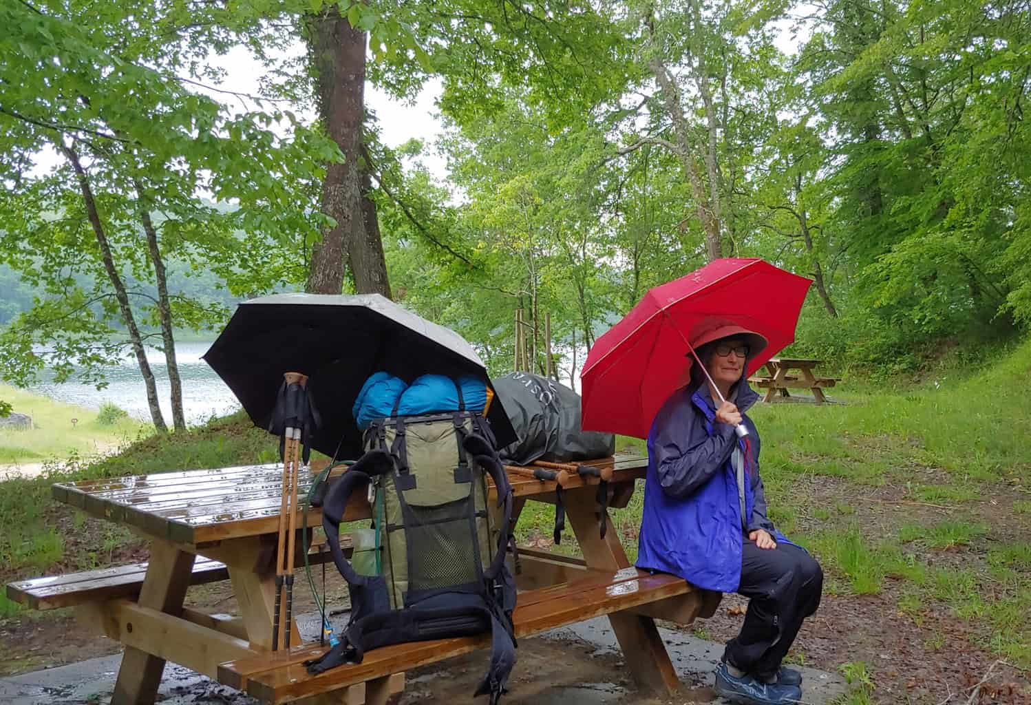
Lunchtime on the Vezelay Camino Route, France 2018.
3.Better condensation management in rain gear: As stated above I often use my umbrella in conjunction with my rain gear, every hiker has experienced that clammy wet feeling when trudging along in their rain gear, and often ask themselves, am I really any drier in this sweat jacket? Well with an umbrella the outside of my jacket stays dry reducing the condensation, it also allows me to vent my jacket as I move along minimizing the sweat and condensation against my skin.
4. It’s the door to my tarp: When using a flat tarp as a shelter I will often open my umbrella and use it at my head as a makeshift door. While this will not keep out the critters, I have often found it to be a great way to create a small wind break at night. It also provides the mental security of nothing looking at my mug while I sleep soundly in the woods.
5.Protection during nighttime bathroom trips: The only thing worse than trudging through the rain for days on end is when you lay awake at 3 am in your shelter as the rain comes down debating if you should get up and pee or try to hold it until the morning. No one wants to fight getting on rain gear to relieve themselves, but with an umbrella this task becomes easy. Simply crawl out of your bag, slip on your shoes, deploy the umbrella and now you have a dry place to go relieve yourself.
6.Moon blocker when cowboy camping: I cannot tell you how many times I have been cowboy camping only to be wake up in the middle of the night by a big fat moon shining it’s light down on me like a spotlight. Instead of trying to get creative using my Buff as a sleep mask, I simply open my umbrella, and lay my head under its canopy for a great light blocker.
7.Dry place to cook: I won’t get into the details here, but in 2016 I might have burned a whole in the side of my pyramid tent when I was cooking inside trying to avoid the rain. While I came out of the situation unscathed, I can’t say the same for my shelter. I realized that I had the perfect place to stay dry while cooking the whole time – my umbrella. Now when it’s time to heat up some water and cook the morning or evening meal (cold soaking is for folks much harder than me), I simply sit under my umbrella nice and dry.
“I encourage you to consider getting an umbrella before you set off on your next hike. Our Silver Shadow family of umbrellas includes 3 different models to suit everyone’s budgets, both financially and weight wise.”Happy Trails, Whitney “Allgood” LaRuffa
#2. Nope, It’s Not Dew. “Have you ever gone outside on an early spring morning and spied ‘dew’ on the tips of grass blades or along the margin of the leaves? It may actually be guttation, a mixture of plant internal juices that are exuded overnight.” David L. Nelson has the scoop in Bay Nature Magazine.
Susan: I never took biology so I know little about the photosynthesis (part of the process by which plants take in carbon dioxide and give off oxygen). This article, which I found fascinating, explains part of this process and why what we may have thought was dew is from fog, etc. from the air around us is actually juices excreted by the plant itself.
Nelson continues: “However, at night, photosynthesis shuts down and the stomata are closed, conserving water. If the soil is moist, the root pressure will increase the pressure in the xylem, forcing the leaf to offload some of the fluid. You could think of it as an emergency escape route. When the plant needs to release fluid, and the stoma are closed, the fluid finds another way out. It exits through specialized pores called hydathodes; they are located at the tip of the blade of grass or at the margin of a leaf, typically at the tip of a marginal tooth or serration. If the humidity is high, the guttation does not rapidly evaporate, but accumulates at the leaf tip.”
#3. Gear Cleaning, Repair, and Maintenance. Treeline Review https://www.treelinereview.com/subscribe provides info on how to “clean and repair the gear you have —so you don’t need to buy new.” This is invaluable information for anyone venturing into the backcountry. All the articles in this overview: Cleaning, Repair, and Maintenance. The individual articles:: How to Fix Zippers on Outdoor Gear , Clean and Repair a Down Jacket, Clean and Repair Gore-Tex and Waterproof Shells, How to Wash a Tent, How to Wash a Sleeping Bag, How to Repair a Tent
Treeline Review online is free and it’s well worth your time to read their newsletters.
#4. New rules for airlines should benefit passengers. The Transportation Department on Wednesday, April 24, announced new rules—they are to help with refunds, and avoiding surprise fees late in the booking process.
“Passengers deserve to know upfront what costs they are facing and should get their money back when an airline owes them — without having to ask,” said U.S. Transportation Secretary Pete Buttigieg.
Some of the new rules/changes are:
“There’s now one definition of a “significant” delay. Now, according to the D.O.T., there will be one standard: when departure or arrival is delayed by three hours for domestic flights and six hours for international flights.”
“Passengers will get prompt refunds for cancellations or significant changes for flights and delayed bags, for any reason. Refunds will be automatic, without passengers having to request them.” They must be made in the form the original purchase was made–check/credit card, etc. and are “due within seven days for credit card purchases and within 20 days for other payments.”
Costs to be given upfront! “Fees for checked baggage and modifying a reservation must be disclosed upfront. Airlines will be required to display extra fees for checking bags and seating selection up front.
The new rules have varying start dates. You can find more details at the United States Department of Transportation link here.
#5. Are Baby Rattlesnakes More Dangerous than Adults? I am seeing reports that many hikers now are seeing plenty of rattlesnakes on their springtime walks.“Q: Is it true that baby rattlesnakes are more dangerous than adults?
A: “No, that is one of the many myths about rattlesnakes, says California Department of Fish and Wildlife (CDFW) Amphibian and Reptile Conservation Coordinator Laura Patterson. The larger the rattlesnake, the more venom it will deliver when it strikes. Rattlesnakes are shy by nature and will only bite as a last resort when they perceive a serious threat to their lives. Typically, a rattlesnake’s first defensive strategy will be to move away from a perceived threat. If cornered or their escape route is cut off, they will seek cover if available. If the threat continues, they usually coil up and rattle as a warning, although some individual rattlesnakes don’t rattle.
“If the threat continues, they may strike. However, an estimated 25 to 50 percent of bites from rattlesnakes are dry, meaning they choose not to envenomate. It takes the average rattlesnake three weeks to replenish expended venom. Because their venom is intended for immobilizing prey, envenomating a threat they will not eat means they cannot eat for several days to weeks. This is why rattlesnakes do everything they can to avoid unnecessarily using their venom.
“Rattlesnakes can occur almost everywhere in California except alpine areas above tree lines on tall mountains. They can also swim. In most areas, peak rattlesnake activity occurs during spring and summer shortly after they emerge from winter dens.” Visit CDFW’s rattlesnake page for tips on rattlesnake safety.”

#6. Regional: S.F. Bay Area: Springtime Hikes in a New Bay Area Preserve. Coyote Ridge. Excerpt from an article by Susan Alcorn. “Welcome to Máyyan ‘Ooyákma — Coyote Ridge.” If you are seeking a hike in the Santa Clara Valley where you likely will find dozens of varieties of wildflowers in springtime, don’t miss seeing the lovely displays at ‘Mayyan ‘Ooyákma — Coyote Ridge Open Space Preserve. This grassland area of more than 1,800 acres opened to the public just last August. In springtime, visitors will find colorful wildflower displays along the trails by signing up for a docent-led hike or going on their own with the required Butterfly Pass. The pass, guided tours, entry, and parking are free.
I was lucky enough to get the last ticket for one of the March 2024, Bay Checkerspot Trail tours. The ticket was for one car — visitors can bring as many people as they can safely fit in their car.
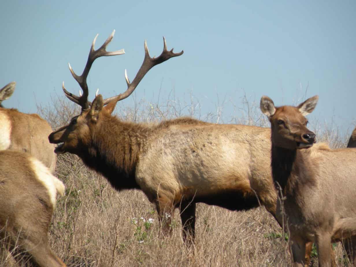
“Mayyan Waayi Overlook Trail starts from the parking lot. It travels 1,000 feet on a short spur leading to a loop at the end (like a lollipop). Its gentle grade (5% average) and firm, stabilized, decomposed granite surface make it partially accessible. It leads to a rise with two scenic viewpoints where serpentine (California’s State Rock), wildflowers during the season, and meadowlarks may be enjoyed. Visitors can also enjoy the shaded picnic area. No permits are required to visit.
“The other three trails, Serpentine, Tule Elk, and Bay Checkerspot, form a loop. When docents lead a hike through the entire 5.1-mile loop, they generally do so clockwise because it’s judged safer. It allows hikers to tackle the steeper Serpentine trail going uphill, then cross the ridgetop along the relatively gentle Tule Elk, and descend the hillside on the series of switchbacks down the moderate Bay Checkerspot.”
This is only a portion of my article. You can read the rest here. We went back to the preserve this week and did the whole loop—actually would differ from the advisory’s rating of difficulty. The three sections do vary, but none IMO are particularly difficult. If you do go, check if the trails/preserve is open, be prepared for hot days in summer, and hiking poles are helpful.
#7. Bay Area Regional: ParkFest: A celebration of 90 Years of East Bay Regional Parks. Saturday, May 11 from 10 a.m. to 4 p.m. Enjoy music, performances, Drakes Brewery, Kids’ Zone, hands-on fun, nature exhibits and displays, food trucks, eco-friendly activities, and more. Lake Chabot Regional Park, 17600 Lake Chabot Rd, Castro Valley, CA 94546. ParkFest is free and accessible to all. A BARTable event, the Regional Parks Foundation is sponsoring free shuttle service to and from the Bay Fair BART station.
“Established in 1934, the East Bay Regional Park District is the largest park district in the nation, with 73 parks, 126,000 acres, and 55 miles of shoreline.
“ParkFest Performers: Grammy Award-Winning Alphabet Rockers, Anthony Ant of Oakadelic, Los Cenzontles, Black Cat Zydeco, White Crane Dragon and Lion Dance Association, the Berkeley High School Jazz Band, Prescott Circus, Asheba Caribbean Music, Silly Circus Show, magic and bubble shows, and more!”
+++++
Thank you everyone. Stay well, keep hiking when prudent. I encourage you to send in items of interest to the hiking community to me at backpack45 “at sign” yahoo.com
Susan ‘backpack45’ Alcorn
Shepherd Canyon Books, Oakland, CA
https://www.susandalcorn.com
https://www.backpack45.com
Author of Walk, Hike, Saunter: Seasoned Women Share Tales and Trails; Healing Miles: Gifts from the Caminos Norte and Primitivo; Patagonia Chronicle: On Foot in Torres del Paine; We’re in the Mountains Not over the Hill: Tales and Tips from Seasoned Women Backpackers; and Camino Chronicle: Walking to Santiago.
Please note: Hiking and backpacking can be risky endeavors. Always be prepared for emergencies and carry food, water, shelter (warm clothing, etc.), flashlight/headlamp, matches, first aid supplies, and maps. Cell phones don’t always work. Leave word where you are traveling and when you are due back.

 Susan Alcorn ©0169
 ;
;
 #6. Camino Gathering and Hospitalero Training. “Get Prepared for the 2022 Gathering!” Dave Donselar, Chair of the 2022 Gathering, shares the details. The 2022 Annual Gathering of Pilgrims is will be held in Alexandria, VA. “This will be American Pilgrims on the Camino’s 25th year of gathering pilgrims together and we look forward to seeing you at the YMCA Blue Ridge Assembly in Black Mountain, NC (near Asheville) from March 31 to April 3, 2022.