Hike to Mount Wanda in Muir’s historic site

Our Nifty Ninety hike led to not only a peak, but also some confusion — which I’ll go into in a bit.
As hikes go, the one to Mount Wanda, part of the John Muir Historic Site off Highway 4 in Martinez, CA, was short and moderate. It was less than three miles round trip, and involved a steady climb to the highest peak.
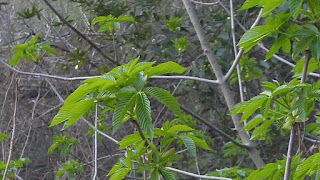
While enjoying our current trend of sunny skies and 75-degree weather, we ascended through oak, buckeye, and bay trees on a wide, fire trail. Because we had some rain a couple of weeks back in late January, the hillsides are still a luscious emerald green.

It’s wildflower season at Mount Wanda
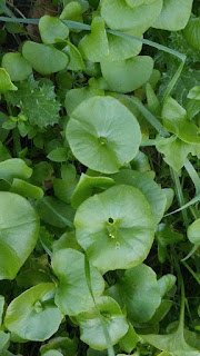
Miner’s Lettuce (indeed helpful for California miners back in Gold Rush days) was abundant trailside. Wildflowers — lupine, poppies, fiddleneck — should be out in a month of so.
About a half mile along, we reached open land where views of the surrounding area opened up. The parcel is only 325 acres, so the industrial areas and housing developments aren’t far away, but looking farther to the east or north one can enjoy seeing Mt. Diablo, the Benicia–Martinez Bridge, the Carquinez Strait, the wind turbines along the ridges near Rio Vista, and, faintly, 125 miles away, some remaining snow on the Sierras.
Most of the signboards were stripped clean of information (probably as a result of vandalism, but maybe a lack of funding to keep them updated), but there were a few picnic tables and benches along the way. We stopped to check our GPS in order to locate Wanda Peak, which is on the Nifty Ninety Peak challenge.
The GPS indicated the peak was nearby and so we climbed a small rise and reached the indicated point. There wasn’t any kind of marker or post at the top, but the GPS was happy and Mount Wanda’s elevation was listed as 640 feet, so we assumed we were in the right place.
Coming back down to the main trail, we stopped at a crossroads, found a bench and sat to eat lunch. Then we turned right for a short distance and found a sign board with a torn page with some information about the Nature Trail. We continued on the dirt path indicated for a very pleasant loop around the hilltop. It descended gradually, eventually dropping down to a couple of wooden foot bridges that would be useful when the creek was full. We rejoined the fire road to continue back to the trailhead and our car.
Yet, we were still a bit perplexed by the lack of identification or information on Mt. Wanda. Wanda was one of John Muir’s two beloved daughters — how could the NPS not have some sort of monument at the summit?
 Which peak is Mount Wanda?
We had read a story that John Muir had written about taking “my babies” on a walk one day. He told Wanda, his the elder daughter, that he had named a peak on the property after her. And when the Helen, his younger daughter protested, he named another peak (very nearby) after her.
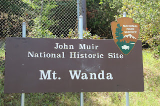
Our confusion grew because we had seen a higher peak while on the hike we did. We did some searching and found that it was 660 feet. To compound our confusion, the USGS (United States Geological Survey) showed the peak we had reached was 640 feet and marked it ‘Mount Wanda’. However, the National Park Service sign at the start of the trail showed the nearby peak, which we hadn’t climbed, was 660 feet and had labeled that peak ‘Mount Wanda’.
Clearly there was some problem with the signage, but with the help of David Sanger, who has climbed this peak and hundreds more, we sorted it all out and now know that we can check Mount Wanda off our list of peaks on the challenge!
Don’t worry about the confusion. All Trails shows it all very clearly here, so get ready to enjoy a nice hike and views in the park. Mount Wanda is 643 ft., Helen is 659 ft. Enjoy!
Note
If you decide on a hike in the Mount Wanda site, be aware that there are no restrooms. You can find them across Hwy. 4 at the John Muir House. The John Muir House is a delightful place to visit, so I recommend you take the tour. You can wander around the grounds on your own, but reservations may be necessary to tour the house itself because the site is popular with school groups.
Bring water and sunscreen; this area can be very hot during the summer. Dogs are allowed, on leash.
Hiked: Feb. 6, 2018. Our 15th Nifty Ninety hike.
