“Hope, sanity, compassion, thoughtfulness, health, recovery — it’s time to WELCOME 2021!” Couldn’t say it any better than how friend Katie Williams recently posted it on Facebook!
The trails await — though many are muddy!
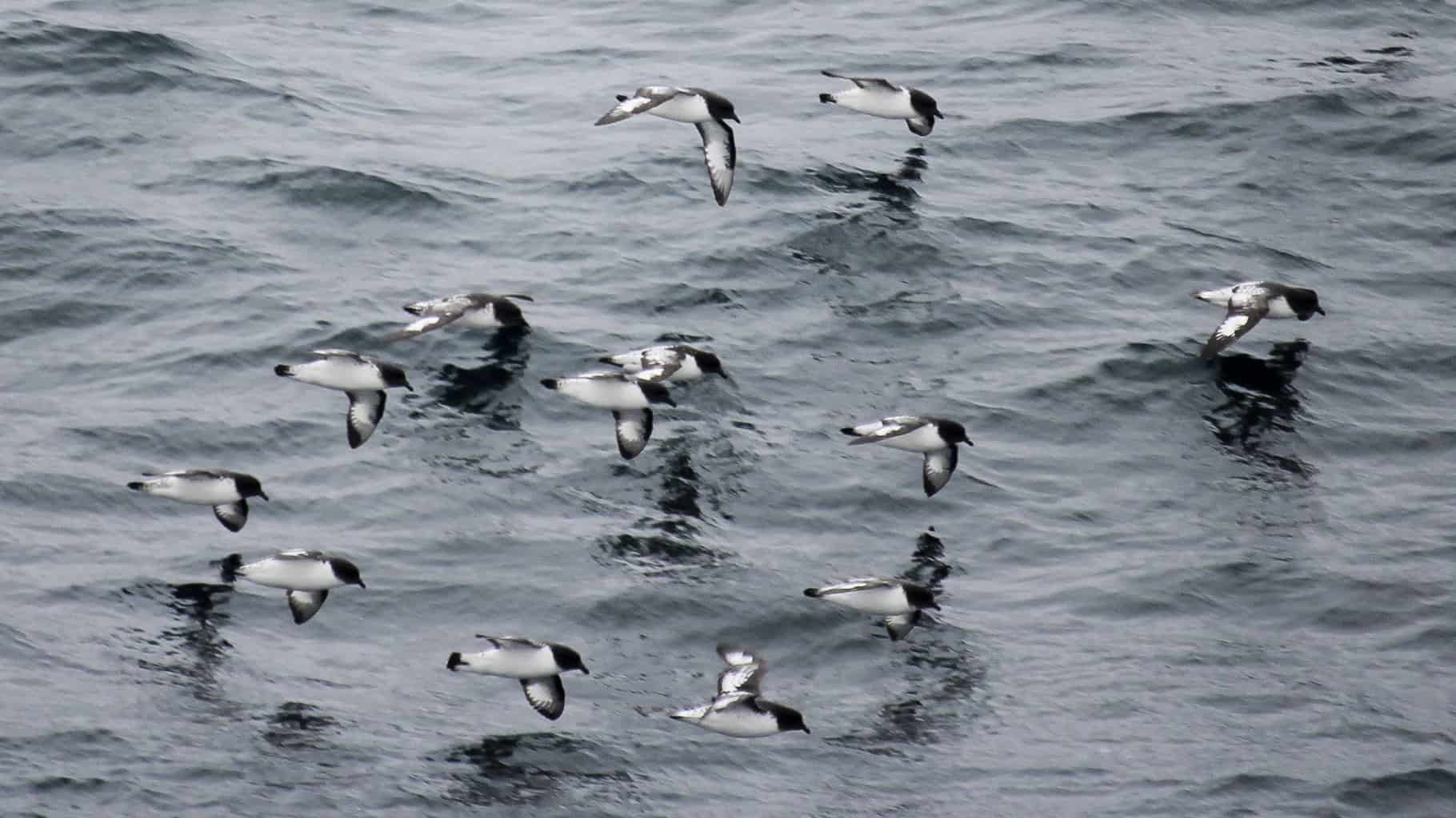
Alviso Slough Trail (near San Jose, CA) Contents:
1. The “New” Cathedral in Santiago
2. Pacific Crest Trail — time to apply for permits coming up soon!
3. Bay Nature: “What’s it like inside a Woodrat Nest? Regional, SF Bay Area: 4. Bay Trail extension coming to Richmond, CA
5. The Alcorns explore new and old local hiking trails
6. Two rewarding hiking challenges for you
Articles: #1. The “New” Cathedral in Santiago: Big happenings in Santiago de Compostela. The cathedral is open to the public again. Ivar, who hosts a Camino forum and manages the Casa Ivar in Santiago, has also been doing a weekly podcast about what’s happening pilgrimage-wise in Santiago. He recently took a walk through the cathedral and gave us a look at the restoration of what he calls the “New” Cathedral. Have a look here. https://www.youtube.com/watch?v=L2sSUoL8tDk&feature=youtu.be
And in further good news, we learn that the Holy Door has been opened and the Holy Year has begun. 2021 is a Holy Year, but because of COVID-19, the pope has expanded the definition and the “year” now continues through 2022. Very good news for those who will not be able to walk the Camino, or otherwise visit the Cathedral this year, but might be able to next. Ivar wrote, “As you might have seen, we will also have a holy year in 2022, so no hurry. https://www.caminodesantiago.me/community/threads/pope-agrees-2022-also-a-holy-year.69116/
Another resource for keeping up with what’s open and what the conditions are on the pilgrimage trails and in Santiago, go to American Pilgrims.org
#2. Pacific Crest Trail Permits: Very good news! It appears that the USDA Forest Service and Pacific Crest Trail are going to issue permits for PCT hikes of 500+ continuous miles of the trail this year. You’ll be able to apply online starting on Jan. 19, 2021 at 10:30 a.m. Pacific Time.
There is a great deal of other important information on the PCTA website. The site also asks hikers to consider whether it is wise to hike the trail during this period when COVID-19 is still very much with us. Link here.
Springtime in Section A of the PCT. Northbound permits for trips starting anywhere from the PCT Southern Terminus at the Mexican border to Sonora Pass will be issued at normal levels of 50 permits per day from March 1 through May 31. Southbound permits for trips starting from the Northern Terminus will be issued at normal levels of 15 per day June 15 — September 15.
If you are on Facebook, you’ll find a lot of information on the PCT Section Hikers group moderated by Jaunting Jan. If you are eager to have good information on the John Muir Trail, look at Inga Aksamit’s Facebook group. She administers the group and the site does a great job of explaining the often confusing rules and regulations of the JMT permitting process, etc.
#3. Bay Nature: “What’s it like inside a Woodrat Nest? When recently walking around our nearby Lafayette Reservoir, a friend and I were talking about wood rat nests, which can be seen from the popular walking trail. So, when I saw this recent article in Bay Nature, I was pleased to learn something new about these cute critters.
Pack rats are also known as wood rats, and even trade rats. I knew that the nests were commonly used for generations (some have been documented at being used for 60 years or more.). And this time of year, when most nearby lower-growing vegetation is bare, it is pretty easy to spot their homes —3-6 feet high, up to eight feet wide, and made of branches, bark, and grasses—but also sometimes wires, glass, and author Michael Ellis adds, old shoes.
Compartments and trading:
I was also intrigued to learn that rats’ homes have compartments—separate chambers for giving birth, sleeping, and pooping. I was also intrigued to learn that the things that they swipe from humans—as disparate items as shoes, jewelry, and gum wrappers—may end up being woven into their homes’ walls. The “trader rat” moniker is appropriate because sometimes they may be carrying home one shiny object, encounter one it finds more appealing, and trade.
Rats are one of the few mammals that can eat the leaves of toyon. The toyon leaves are highly toxic to humans and most other animals because they contain cyanide compounds. But the packrats store the leaves in one of their many pantries until the leeching process breaks down the toxic ingredients, which makes the leaves safe for them to consume! (From Bay Nature, Winter 2021. Michael Ellis.)
#4. Regional, SF Bay Area: Friends of the Bay Trail in Richmond shares great news. The City of Richmond and East Bay Regional Park District (EBRPD) have been awarded $2.2 million for building 2.5 miles of Bay Trail along the shoreline from the Richmond-San Rafael Bridge Trail to the northern border of the City’s Point Molate property at Stenmark Drive. For details, see the CA Natural Resources Agency press release below about award of these Prop. 68 Recreational Trails & Greenways program grants.
These grants complete funding for construction of this $6.5 million project when combined with Plan Bay Area Priority Conservation Area grants of $2.2 million, EBRPD funds from Measures CC, FF & WW, and funds provided to the City by Chevron in 2009 as settlement of litigation over underpayment of utility user taxes. EBRPD has funded design plans now at the 65% preliminary stage, approved a Mitigated Negative Declaration under CEQA and applied for the major permits required. Construction should be completed by the end of 2021.
This will be more than a multi-use trail. It will provide the first public access to this shoreline, other than Point Molate Beach Park, since the Huichin tribe of Ohlone dwelled on this stretch of San Francisco Bay shoreline. The first mile of trail from the RSR Bridge will follow a shoreline easement granted by Chevron to EBRPD, while the remaining 1.5 miles will be on the City’s Point Molate property. Click here for more news.
#5. The Alcorns explore new and old local hiking trails: Like I’m sure many or most of you, we have not been traveling afar recently. However, we are blessed with a good range of hiking trails throughout the region. The EBRegional Parks District (across the bay from San Francisco) is the largest urban regional park district in the US.
Whenever I consider the options we have, due to the individuals, informal groups, environmental organizations, and governmental agencies that have fought to safeguard our open spaces, I marvel at the vision and tenacity displayed. Beyond that, it has been the public as well as private donors who have funded our wealth of recreational sites.
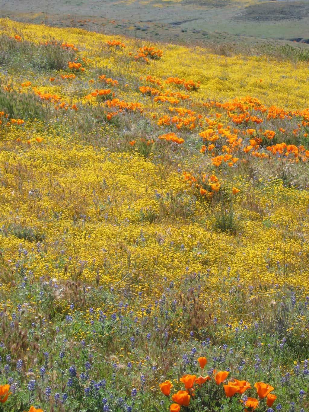
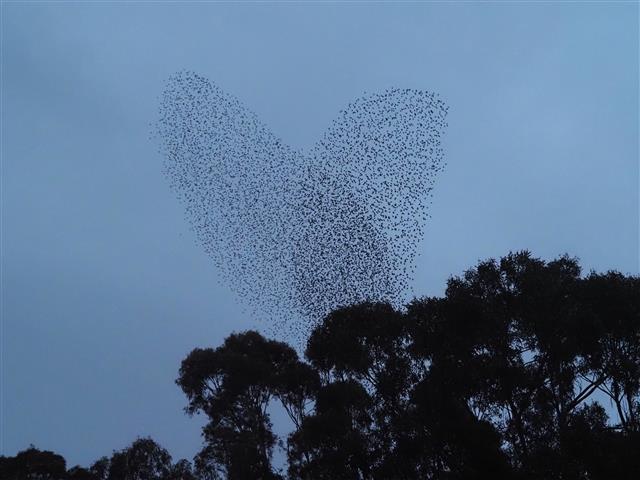
In December, we hiked primarily in wetland areas — Coyote Hills Regional and Don Edwards San Francisco Bay National Wildlife Refuge (Fremont), Arrowhead Marsh/Martin Luther King, Jr. Regional (Oakland); Corte Madera Marsh; Alviso Flood Plain (near San Jose) — because this is bird migration time. We also watched, a couple of times, a murmuration, an incredible display by tens of thousands of starlings swooping and weaving incredible patterns in the sky before they landed in nearby eucalyptus trees at dusk.
Murmuration (starlings) in San Rafael, CA
#6. Two of the 2021 hiking challenges in the Bay Area #PixInParks Challenge. Santa Clara County Park System. Complete all seven featured hikes and get a tee shirt of bandana. Parkhere.org
#Trail Challenge 2021. East Bay Regional Parks. There are twenty featured trails, you choose whichever ones you want to compete and “to complete the challenge, hike five of the 20 trails – or 26.2 miles of trails within East Bay Regional Park District.”
The “twenty featured trails are now available on the AllTrails app. First download the free app, sign-up and log in, then go to https://www.alltrails.com/lists/ebrpd-trails-challenge-2021 and click on “Copy to my lists”, followed by “Continue in App”. The featured trails will show under ‘Lists’ in ‘Plan’. The app indicates where you are on the trail, enabling easy return to the trail if you stray from it. You can also record your hikes, and share your photos, comments etc. with others.” More info here.
++++
Thank you everyone. Stay well, keep hiking when prudent—and I encourage you to send in items of interest to the hiking community.
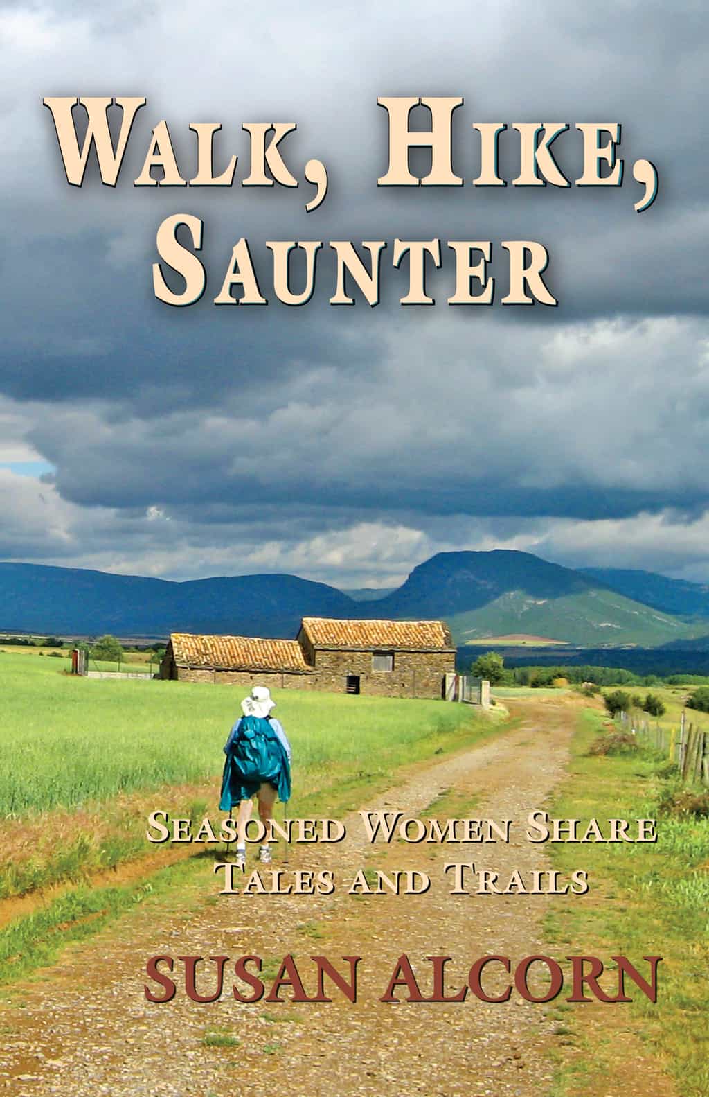
Author: Walk, Hike, Saunter, which is now available in both print and Kindle versions!
Also: Healing Miles: Gifts from the Caminos Norte and Primitivo, Patagonia Chronicle: On Foot in Torres del Paine; We’re in the Mountains Not over the Hill: Tales and Tips from Seasoned Women Backpackers; and Camino Chronicle: Walking to Santiago. All are available in both paperback and Kindle versions.
Please note: Hiking and backpacking can be risky endeavors. Always be prepared for emergencies and carry food, water, shelter (warm clothing, etc.), flashlight/headlamp, matches, first aid supplies, and maps. Cell phones don’t always work. Leave word where you are traveling and when you are due back.
To subscribe, unsubscribe, or send message to this (almost) monthly newsletter, please send a message to Susan at backpack45 “at sign” @yahoo.com
*** we are moving the newsletter from the News page to the blog, so each newsletter can be linked to independently – on the news page there will be a link to the newsletter ***
Susan Alcorn’s Backpacking & Hiking Tales and Tips, December 2020
Happy holidays!
Contents:
1. As Hiking Surges During the Pandemic, So Do Injuries
2. Audio walks—armchair and onsite
3. Camino Masks
4. Treeline Review helps with finding good gear for gifts!
5. Drawing the Colors of Winter
6. Wearing a Mask While Running
7. Past, Present and Future on the Bay Area Ridge Trail.
Walk, Hike,Saunter is Now Available… Long-distance hiker Susan Alcorn introduces you to 32 experienced outdoors women who consider hiking to be an essential part of their lives. Their stories are told with honesty, insight and humor. They share their wisdom and proven tips to inspire women and men of all ages.
The women, all 45 and older and in the prime of their lives, are superstars—shining examples of the richness that hiking can bring to our lives. All told, they have hiked tens of thousands of miles.
The Contributors The list of contributors is sort of a Who’s Who in the hiking world: Inga Aksamit, Barbara Anderson, Beebe ‘Jack from Ireland’ Bahrami, Jan ‘Pooh Bear’ Barlow, Jane Blanchard, Carolyn ‘Ravensong’ Burkhart, Judy Chovan, Emilie ‘Dirty Emilie’ Cortes, Lynne ‘Sparkly Manaña’ Davidson, Marion ‘llamalady’ Davison, Mary E. ‘Pastor Mary’ Davison, Laurie Ferris, Lorie ‘Veggie’ Florence, Laurel (Ibbotson) ‘Happy Feet’ Foot, Nancy ‘Why Not?’ Huber, Naomi ‘The Punisher’ Hudetz, Sandy ‘Frodo’ Mann, Jan ‘Jaunting Jan’ McEwen, Karen ‘Butterscotch’ Najarian, Sylvia ‘amaWalker’ Nilsen, Marcia ‘GottaWalk’ Powers, Nancy Reynolds, Lisa Robinson, Dami Roelse, Donna ‘L-Rod’ Saufley, Patricia Schaffarczyk, Diane ‘Piper’ Soini, Diane Spicer, Jane Toro, Elsye ‘Wandering Chardonnay’ Walker, Katie Williams, Sue ‘Leapfrog’ Williams.
The women hikers represent a range of interests. Some are into long-distance hiking and have earned awards for their accomplishments. Others include trail volunteers or trail angels who have spent considerable time giving back to the hiking community.
A common theme running through Walk, Hike, Saunter is that there are many paths to incorporating hiking into your life. Whether hiking is one of many things that you enjoy doing, or whether you find it such an passion that you don’t mind living out of your car in order to pursue it—you can reap the rewards of exploring the world on foot. As you immerse yourself in nature, enjoy new vistas, and perhaps experience interesting cultures, you’ll improve your health and fitness and enrich your life.
Walk, Heal, Saunteris now available in paperback on Amazon, and on Kindle. Your favorite bookstore can order it for you through Ingram distributors. ISBN-13: 978-0936034072.
My new book, “Walk, Hike, Saunter: Seasoned Women Share Tales and Trails” will be published this fall.
For years, I have thought about writing a new book about women hikers; Covid 19 and its restrictions has helped it come to pass. It’s not that I wanted to be told to shelter-in-place, or to have to cancel exciting travel plans, but at least this time has provided an opportunity to do something creative at home.
Walk, Hike, Saunter… is for hikers, especially women, who are looking for motivation, encouragement, information, and inspiration to put on their trail shoes and get on hiking trails here and abroad. It features the contributions of thirty-two wise women, all 45 years of age or greater, who share their sometimes humorous, occasionally frightening, always open stories of the joy walking brings to their lives.
How and where—the sharing begins They tell where they hike, and how they keep going when things get tough. The stories they tell are the ones they would share at hiker gatherings and around a campfire (if time and circumstances allow).
There’s more to come! We’ll soon be posting more details about the book here—in particular the names of some of the women who are included. If you are active in the long-distance hiking community, you’ll recognize several because of their extraordinary feats—such as earning the Triple Crown Award for completing the Appalachian, Continental Divide, and Pacific Crest Trails.
However, there’s something for all hikers Walk, Hike, Saunter is for anyone who hikes—whether in their neighborhood, on the paths in their local parks, or along long-distance trails in the U.S. or abroad.
This has been a wonderful project for me because of all the generous and accomplished women I have been able to work with—hearing their stories has been inspiring—and helped me stay (somewhat) sane during these trying times.
I am very excited that we at Shepherd Canyon Books will soon be able to share Walk, Hike, Saunter with readers.
January 1, 2020. After the days of exploring the Falklands and South Georgia and the few intervening days totally at sea, I could hardly wait to touch down in Antarctica. This was the day!